 With spring just around the corner here in the southwestern United States, it’s time to start scouting out places for wildflowers. And, one of the best ways to do that is to look at winter precipitation data.
Precipitation isn’t the only thing that affects a good wildflower show, but it can usually be a strong indicator of where the good spots will be (especially in areas that receive little rain to begin with, such as the desert).
So, where do you find all this great precipitation data? Well, there’s two sources I’m relying on this spring:
#1 – National Weather Service (NWS)

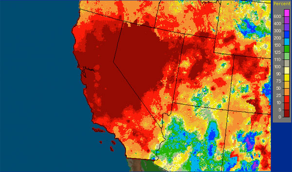
The National Weather Service (NWS) has a helpful website where you can check out historical precipitation data. If you set the timeframe to “Archive: month/year” then you can see what the precipitation was like in a specific month. Then, in that “product” list, I usually click on “percent of normal” to pinpoint the areas that got the most precipitation (relative to what they normally get). To zoom in on an area, just click on the map. Unfortunately, you can’t zoom in very far.
As you can see from the image above, we didn’t get much precipitation in California this winter 🙁
#2 – Weather Underground

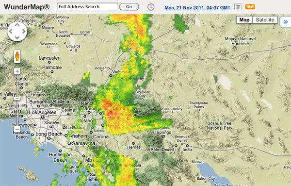
My favorite website for weather forecasts, Weather Underground, just added a new feature to their excellent WunderMaps webapp: the ability to see what the weather was like at any given day in the past (you can even compare different hours of the day). This is helpful because now you can easily track some of the big storms that occurred over the winter. And, in dry places like the desert, sometimes just one storm is enough to create a nice wildflower display.
What did I miss?
If you know of another great source for checking historical precipitation data (especially if you know of a site that lets you zoom in more than the NWS site), please tell us about it by leaving a comment below! Thanks 🙂
If you enjoyed this article, and would like to read more, please signup for free updates by email or RSS.
 About the Author: Steve Berardi is a naturalist, photographer, software engineer, and founder of PhotoNaturalist. You can usually find him hiking in the beautiful mountains and deserts of southern California.

For anyone in agriculture or the water business, it would be handy to be able to check the accumulated precipitation for the last 9 months (since the last wet season), to best guage ground water replenishment and crop choices. But that information seems to be lacking.